Maps in Progress
I'm working to expand the maps that I originally put together for the 46th District Democrats from the datafiles that Roger Crew has on the 41st District website. They use Google Maps and some modified shapefile data. All of King County's maps are available on 46dems.com and have been combined with the Election History records made available by Fred Morris. Rob Dolin has put up merged pages on kcdems.org. It's amazing what kinds of information is out there in the public domain, and all it takes is a plan to put things together into a useable format.
On April 2nd, Jason Copeland was able to get the shapefiles for the Snohomish County precincts, and Roger did his conversion to his Javascript data format. Getting these maps posted with a common interface is my next goal, and with Progressive Majority being willing to continue to fund the website hosting of Democracy for Washington, I finally have a home for them. I'll be working on these maps over the next few weeks.
I'm also having a lot of fun working with Google Earth. I found a converter that can take any shapefile opened in MapWindow GIS and save it as a .kml file for use in Google Earth and Google Maps. The first one that I put together is a map of where the Sound Transit Link Light Rail system will be going.
I'm running into some problems, mostly because I'm just starting with GIS, and a lot of the data that I'm finding is designed to work alone instead of playing nice with other datasets. For example, the Oregon Secretary of State has shapefiles for that state's House and Senate districts, but while the longitude points are accurate it's odd seeing Oregon show up just north of the Equator in the Pacific Ocean. I'm not sure how to fix that yet. I also found that the Census.gov shapefiles for the Washington State Congressional Districts from the 108th Congress show up as a tiny little map just below the equator. The 110th Congress datafiles are much better.
This page will provide links to the maps that I have put together, and I'll like to invite other GIS experts to comment. I need all the help I can get, and I really want to get the data, both maps and election history, from all of the other counties around the state.
Maps Completed
- Sound Transit's Link Light Rail
- Washington's 110th Congress

- Washington State Senate 2006 (.KMZ) - Open in Google Earth only. This file is too large to view in Google Maps.

Maps in Progress
- Washington State House 2006
| < Spread the word - the occupation of Iraq has spread to Grays Harbor | Mukilteo Council approves historic investment in roads and parks > |

|


Challenging the Corporate Media Blockade 
|

|


 WA PEACE LINKS |
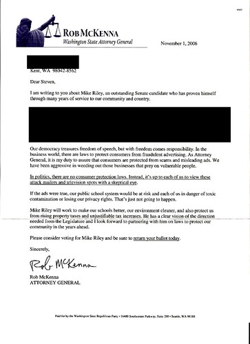
 ABUSE OF POWER Inspired by Rob McKenna's Fake Attorney General Letterhead GIF of Letter |

PNW TOPIC HOTLIST

Recommended Diaries
- Summary of state impeachment activities by Tom Barnard
Democracy Denied - Impeachment Gets Derailed in Washington State By Tom Barnard May 28, 2007 The road to impeachment is not
By eridani (4 comments) - Deauthorize the War Now
According to iCasualties.org, as of today 3513" American soldiers have lost their lives in the war in Iraq. A look at
By Ken Camp (7 comments) - Conference with Congressman Jim McDermott
My Committee met with Jim McDermott in his office the other day. The dialogue reminded me that the kindly and thoughtful
By dinazina (8 comments) - The hypocrisy of Patty Murray
Below the fold is a letter I will be faxing to Sen. Patty Murray (D-WA) when I get to my office
By IvyTodd (7 comments) - The Music Never Stopped--Riding Out the Horrors of a Town Under Siege
"You can't leave," was the word at the door. "There are snipers loose with AK-47s." Danger on all sides. To leave
By charlesdickey (11 comments) - Joel Connelly SwiftBoat Veteran For Righty Memes
Good 'ol Joe - We can count on Joe to pull an Adam Nagourney and do some white house stenography when
By rmdSeaBos (26 comments)
Recent Diaries
By RonK Seattle (0 comments)
By Karen Backman (1 comments)
By cihawkes (0 comments)
By Karen Backman (3 comments)
By jeffuppy (7 comments)
By IvyTodd (2 comments)
By eridani (1 comments)
By Karen Backman (17 comments)
By ThinkerFeeler (1 comments)
By robespierrette (1 comments)
By IvyTodd (0 comments)
By IvyTodd (1 comments)
By zappini (0 comments)
By cihawkes (0 comments)
By Pen (5 comments)
Related Links
+ 46th District Democrats+ 41st District website
+ Google Maps
+ 46dems.com
+ kcdems.org
+ Progressiv e Majority being willing to continue to fund the website hosting
+ Google Earth
+ MapWindow GIS
+ Link Light Rail
+ Oregon Secretary of State has shapefiles
+ This page
+ Sound Transit's Link Light Rail
+ Washington 's 110th Congress
+ Washington State Senate 2006
+ chadlupkes's Diary
Washblog RSS Feeds
Political Contacts
Local Media
Aberdeen Daily World
Chinook Observer
Montesano Vidette
Pacific County Press
Willapa Harbor Herald
KXRO 1320 AM
Peninsula Daily News
Bremerton Sun
Bremerton Chronicle
Gig Harbor Gateway
Port Orchard Independent
Port Townsend Leader
North Kitsap Herald
Squim Gazette
Central Kitsap Reporter
Business Examiner
KONP 1450 AM
Anacortes American
Bainbridge Review
Voice Of Bainbridge
San Juan Journal
The Islands' Sounder
Whidbey NewsTimes
South Whidbey Record
Stanwood/Camano News
Vashon Beachcomber
Voice Of Vashon
KLKI 1340 AM
Bellingham Herald
The Northern Light
Everett Herald
Skagit Valley Herald
Lynden Tribune
The Enterprise
Snohomish County Tribune
Snohomish County Business Journal
The Monroe Monitor
The Edmonds Beacon
KGMI 790 AM
KELA 1470 AM
KRKO 1380 AM
King County Journal
Issaquah Press
Mukilteo Beacon
Voice of the Valley
Federal Way Mirror
Bothell/Kenmore Reporter
Kirkland courier
Mercer Island Reporter
Woodinville Weekly
Seattle PI
Seattle Times
KOMO TV 4
KIRO TV 7
KING 5 TV
KTBW TV 22
KCTS 9
UW Daily
The Stranger
Seattle Weekly
Capitol Hill Times
Madison Park Times
Seattle Journal of Commerce
NW Asian Weekly
West Seattle Herald
North Seattle Herald-Outlook
South Seattle Star
Magnolia News
Beacon Hill News
KIRO 710 AM
KOMO AM 1000
KEXP 90.3 FM
KUOW 94.9 FM
KVI 570 AM
Tacoma News Tribune
KCPQ 13
UPN 11
Tacoma Weekly
Puyallup Herald
Enumclaw Courier-Herald
The Olympian
KAOS 89.3 FM
The Columbian
Longview Daily News
Nisqually Valley News
Lewis County News
The Reflector
Eatonville Dispatch
Ellensburg Daily Record
Levenworth Echo
Cle Elum Tribune
Snoqualmie Valley Record
Methow Valley News
Lake Chelan Mirror
Omak chronicle
The Newport Miner
The Spokesman-Review
KREM 2 TV Spokane
KXLY News 4 Spokane
KHQ 6 Spokane
KSPS Spokane
Statesman-Examiner
Othello Outlook
Cheney Free Press
Camas PostRecord
The South County sun
White Salmon Enterprise
Palouse Boomerang
Columbia Basin Herald
Grand Coulee Star
Walla Walla Union-Bulletin
Yakima Herald-Republic
KIMA 29 Yakima
KAPP TV 35 Yakima
KYVE Yakima
Wenatchee World
Tri-City Herald
TVEW TV 42 Tri-cities
KTNW Richland
KEPR 19 Pasco
Daily Sun News
Prosser Record-Bulletin
KTCR 1340 AM
KWSU Pullman
Moscow-Pullman Daily News
|
